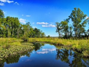
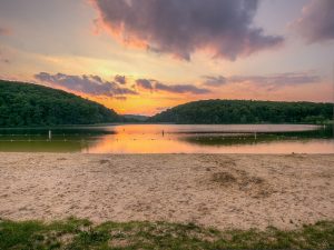
We’re switching gears for this week’s About the Basin. Instead of extolling the virtues of a nature reserve or state park, we’ll be travelling down a short stream just south of Washington, D.C. called Piscataway Creek and discovering all the treasures it has to offer.
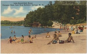
Beginning just north of Rosaryville, Maryland, the Piscataway runs just 4.5 miles long. The headwaters pass through Piscataway Creek Stream Valley Park. This park is difficult to access and has few trails. However, if you are in the area, stop by Cosca Regional Park. The main feature of this park is Lake Cosca, which runs into Butler Branch, a tributary of Piscataway Creek. Boat rentals and overnight camping are available in this 690-acre park near Clinton, Md.
Photo credit: Piscataway Creek Canoe Trip (9), Rob Bole, Flickr
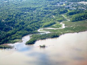
About the time Piscataway Creek flows under Indian Head Highway (Route 210), it opens-up into an embayment that provides a variety of recreational opportunities, including hiking, boating, fishing, and educational adventures. The Piscataway Creek Trail can be found on the north side of the embayment. The highlight of this park is a short, easy hike with beautiful views of the river. Just west of the trail is Fort Washington Marina which offers two boat ramps and lots of parking.
Beyond the recreational opportunities, this area is rich with history. The mouth of the river is directly across from George Washington’s Mount Vernon and is largely protected because of its view of this historic piece of land. But long before George Washington dug a hoe into the ground, the Native Americans considered the area a special place. Many organizations work to preserve the history of this creek and its embayment.
On the west side of the marina is Fort Washington Park, one of the few forts still in its original form along the east coast of the United States. An important Potomac River stronghold, this fort showcases how it has adapted to the advances in artillery, ships, and warfare over the past two centuries.
Across the river from the fort is National Colonial Farm at Piscataway Park. In addition to a boat ramp, hiking trails, arboretum, and forest restoration projects, the park hosts a living history farm from the colonial period. Visit the farm to learn what it was like to live as a middle-class family before the American revolution (spoiler alert: they didn’t have wifi!). Join the farm this Saturday (and every Saturday) for Green History Saturday, a look at environmental issues and their relation to contemporary sustainability.
Just west of National Colonial Farm is Alice Ferguson Foundation’s Hard Bargain Farm, an environmental center focused on sustainable agriculture and cultural heritage. Most of the farm’s programs are for local students and teachers, but the center occasionally opens to the public for special events.
Looking to combine water activities and history? As part of Potomac Riverkeeper Network’s Riverpalooza lineup of summer activities, many will load into canoes and kayaks for a Piscataway Creek Paddle to learn about the history of this beautiful creek this Saturday, June 17. Find information on this event and many other fun activities on ICPRB’s Calendar of Events.
Much like National Donut Day and Eat Ice Cream for Breakfast Day (June 2 and February 4, respectively, because I know you were wondering), National Get Outdoors
Day on June 10 is a day worth celebrating. As part of this holiday, Mason Neck State Park is hosting the first annual Back to the Bay Day. It will be a day full of live music, local food, drinks, and fun.
Experience the National Park Service’s mobile visitor center, tour Belmont Bay, and sample local oysters at this one day
Photo Credit: Virginia State Parks on Flickr
event that celebrates National Get Outdoors Day and the Chesapeake Bay. Back to the Bay Day is designed to increase public awareness of our regional waterways, from local streams to the entire Chesapeake Bay, and garner excitement for this valuable resource.
Volunteers are needed for Back to the Bay Day. Those interested in volunteering can contact Laura Grape via email or at 703-324-1460.
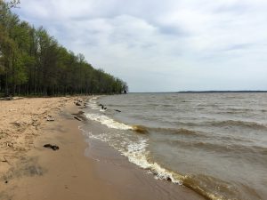
We don’t want you to stop your outdoor escapades just at one day of adventures, though. Mason Neck State Park is a great place to visit the whole year-round. Less than an hour drive south of Washington, D.C., it is tucked into a peninsula between Belmont Bay, Occoquan Bay, and the Potomac River, and spans more than 1800 acres. Located within the park and listed on the National Register of Historic Places are a Native American camp and a plantation owned by the family of George Mason.
Birding is one of the more popular activities in the park, which is thought to be one of the best places to spot Bald Eagles in northern Virginia. Just to the east of the park is a tract of land called the Elizabeth Hartwell Mason Neck National Wildlife Refuge, which was established specifically as a refuge for these majestic creatures.
Looking to get out on the water? Rent a kayak or canoe near the visitor’s center and make your own adventures out on the bay. You can also enjoy the several miles of paved trails by renting a bicycle from the park. If you plan on being there for lunchtime, be sure to bring your own food. There are not many places to purchase food in the area.
So, enjoy National Get Outdoors Day, but think about making it National Get Outdoors Week, or Month, or maybe even Year. There is so much to see and do in the beautiful Potomac River watershed. Many of these great events are listed on ICPRB’s Calendar of Events, including a Twilight Paddling Adventure at Mason Neck State Park the evening after Back to the Bay.
Just on the border of Montgomery County, Md., In the southeast corner of Frederick County, sits 1800 acres of bucolic countryside known as the Monocacy Natural Resource Management Area (NRMA). Search the internet for this spot and you will not find much information. Staff at the Maryland Department of Natural Resources is working hard to change that. “We are in the process of revamping the trail system to create a 7 to 8-mile loop of different trails,” says Shea Niemann, Assistant Manager of Seneca Creek State Park, which is tasked with maintaining the area.
Maps, trail clearing, blazes (colored marks that help a hiker find the trail), and more are in the works for this gem in the rough. Two historic spots will be highlighted along the newly created trails: an historic lime kiln and lime quarry, which were used to build the Monocacy Aqueduct. Although working with a small staff, Niemann hopes to have this work completed by the end of summer.
The current unmarked, roughly maintained trails have not stopped the hikers, hunters, and horseback riders though. Park staff encourage multi-use recreation. “We educate the hunters and the hikers to share the park,” stated Niemann. This includes advising hikers to stay on the trails and wear orange during hunting season.
A parking lot is located along Route 28 (6567 Dickerson Road, Dickerson, Md.), just south of a picturesque bridge that crosses the Monocacy River shortly before it empties into the Potomac River. A boat launch into the Monocacy River is located off Park Mills Rd.
Organized by a partnership between the Interstate Commission on the Potomac River Basin and Prince George’s County Department of Parks and Recreation, last week Northwestern High School in Hyattsville, Md. environmental club students helped make “bag monster” costumes. These costumes will be used by the Prince George’s County Department of Parks and Recreation for their educational programs to teach about the impact of single use plastics on the environment.
The average American consumer uses about 500 bags each year. An estimated 500 billion to 1 trillion plastic bags are consumed worldwide every year. These bags do not biodegrade, instead they photodegrade—breaking down into smaller and smaller toxic bits. They pollute our waterways, leaching toxic chemicals into the soil and water and harm aquatic wildlife.
If you want to learn more about this program or would like to volunteer, contact Antonia Bookbinder of Prince George’s County Department of Parks and Recreation.
ICPRB had a big year in 2016. We are excited to share our projects, activities, and research with the residents of the Potomac River basin. After all, you are the reason we do the work we do. Protecting and preserving the Potomac River and its related resources is not only our mission, it is also our passion. Please take a moment to explore the work we did last year, as well as a recap of how the Potomac River fared in 2016.
On behalf of the ICPRB Commissioners and staff, I wish you a happy New Year, and pledge that the Commission, in partnership with the basin states and our many agency partners will spend 2017 working for a healthier Potomac basin.
We begin this New Year by reinstituting the Commission’s newsletter, the Potomac Basin Reporter, distributed electronically to save money and trees. The Reporter, published quarterly, will join the Potomac News Reservoir, social media pages, and our website in keeping basin stakeholders informed about Potomac basin water quality and resources issues and how ICPRB and other agencies are working to protect the river’s values.
In addition, the Reporter will include stories about the places, people, and activities that make the basin’s waterways an important part of residents’ lives. We also will publish updates on the river’s flow and how it changes seasonally and annually, as well as other features.
The Reporter will afford us a chance to provide lengthier, more-complete articles on subjects affecting the basin’s water quality, quantity, and resources. It also will allow opportunities to encourage the public stewardship needed to ensure the basin’s resources for future generations.
We are excited to begin this effort to create a more informed and involved community focused on preserving and improving the health of the Potomac River and its many uses. We welcome comments and criticism that will help make this effort useful and valuable to the basin’s residents. We look forward to hearing from you.
H. Carlton Haywood, ICPRB Executive Director
Weird River Resident
Let’s play a game called “Guess the Weird River Resident”. Here are your clues: There are 1700 species and they are found on all continents except Antarctica. They look like a tiny version of a creature that would chase you through the woods in Jurassic Park. Stream monitors love to find them as they are a sign the stream is clean, cool and has high dissolved oxygen. The males of the species start a tiny jam band to attract the females. Have you guessed the river resident?
If you guessed stonefly larva, you win! But what about the tiny jam band, you ask? To attract females, the males make drumming and tapping sounds on the rocks. If the prospective lady-friend is interested, she repeats the sounds back to him. The noises are repeated until they find each other, and everlasting insect love. Which, in this case, only lasts 1-3 weeks, the typical lifespan of an adult stonefly. (Photo Credits: Larva by Instagrammar @lizziedee13, Adult by Zachary Smith)
Next Generation Brings Watershed Stewardship to Campus
ICPRB’s Score Four Program makes headway in Prince George’s County, Maryland.
Maryland has more than 10,000 miles of rivers and streams—spanning from the Appalachians to the Eastern Shore—each being of vital importance to the Chesapeake Bay. Our treasured waterways range from small, unnamed creeks in our neighborhoods to the grand Potomac River. They serve as habitats for species that are important to maintaining a healthy ecosystem and provide essential natural services to our environment. We depend on our waterways to help grow our crops, feed our reservoirs, and provide food, drinking water, and recreational activities. The value they provide is of great importance. It is imperative that we keep our streams healthy because the water, life, and pollutants in them eventually flow into larger rivers and the Chesapeake Bay. The quality of the Bay is dependent upon the quality of our streams.
Unfortunately, only 20 percent of Maryland streams meet the criteria for “good” condition. Most streams have eroded stream banks, are polluted and filled with sediment and litter, and lack an abundance of wildlife. With 80 percent of our streams in poor or fair condition, we should all work to protect them and to improve their water quality. This past school year, students in Prince George’s County, Md. did just that. More than 400 students removed approximately 700 square feet of turf grass and replaced it with gardens containing more than 200 native trees and plants that increase infiltration and absorption of runoff, reducing the amount of pollution that enters their local streams.
During the 2015-2016 school year, three Prince George’s County public high schools participated in ICPRB’s Score Four: Students, Schools, Streams, and the Bay program, led by ICPRB educators Rebecca Wolf and Nguyen Le. These schools included the Academy of Health Sciences at Prince George’s Community College in Largo, Northwestern High School in Hyattsville, and Parkdale High School in Riverdale. The Score Four program leads students through the process of exploring their watershed and assessing their school campus in order to develop a Stormwater Action Project aimed at reducing stormwater pollution to local streams.
Students began the year exploring their watershed by researching their local stream and learning about stormwater pollution sources and reduction methods. They were excited to discover that their local stream was within walking distance of campus and learned what they could do to improve its quality. During their research, they learned about the negative correlation between impervious surfaces and stream quality; the higher the amount of impervious surfaces, the lower the stream quality. Impervious surfaces do not allow water to infiltrate into the ground. Stormwater runs directly into storm drains, carrying trash and other pollutants into the stream or river, eventually making its way to Chesapeake Bay.
In the next phase of the program, the students assessed their campus by performing scientific inquiries to determine how their campus contributes to stormwater pollution. These inquiries helped students understand key concepts related to stormwater issues on their campus that would assist them in developing their project. They conducted a campus assessment to identify stormwater paths, problem areas, and possible locations for their project. They also investigated the permeability of the school grounds, as well as soil percolation and composition. With this data, the students determined their secondary project goals and project site, then selected native plants and created a design for their garden. Through this process, the students were able to tailor a project to their individual school campus.
At the Academy of Health Sciences, social studies teacher Carmen Wright and biology teacher Apollo Cordon, envisioned installing a conservation landscape on campus. A conservation landscape reduces stormwater runoff while beautifying the campus and attracting wildlife, such as beneficial insects and butterflies. After performing research, collecting data, and selecting plants, the students used their creativity and math skills to develop potential designs for their garden. Teams of students created 30 potential designs. The students presented their designs to their classmates and used a scoring rubric to judge each design, with the highest scoring design from each class entered into a design contest. Students then voted for the winning design. The final design for their garden centered on an eastern redbud tree as the focal point surrounded by butterfly milkweeds, New England asters, black-eyed Susans, and Joe-Pye weeds, totaling more than 60 plants. Bright orange blooms of butterfly milkweeds with plentiful monarch butterfly caterpillars greeted the students upon their return this fall.
Kari Rowe, an ESOL (English for Speakers of Other Languages) teacher from Northwestern High School, also envisioned a conservation landscape on campus. In the beginning of the program, it was difficult for the students to fully understand the concepts. However, despite the language barrier, the program was able to be adapted with guidance from Ms. Rowe. By the end, the students displayed their understanding and confidence through the success of their garden. The students designed the garden in a classic “bean” shape, planting more than 60 shrubs and perennials. The garden transformed the area with beautiful blooms of blazing stars, black-eyed Susans, and vibrant purple berries on their beautyberry bush.
Environmental science teacher Malka Ostchega had different visions for her students at Parkdale High School. She envisioned installing the beginnings of a food forest on campus that would continually develop throughout the years. Her students researched edible native plants that would meet their site conditions. They planted more than 70 trees and shrubs, ranging from persimmon trees to blackberry bushes to blueberry bushes, on a large hill near the entrance of the school. By selecting to plant on the hill, the food forest is optimally placed to reduce runoff.
At the conclusion of the program, the students celebrated their efforts and their gardens, taking great pride in what they accomplished. One student described how she valued implementing a project to address the problem of stormwater pollution instead of just vaguely talking about how we can help the environment. The students became environmentally knowledgeable and felt driven to continue to make a difference in protecting the valuable assets of Maryland’s landscape.
The success of this program was dependent on the cooperation, hard work, and dedication of the students, teachers, partners, and sponsors. Thank you to the Prince George’s County Department of the Environment and Chesapeake Bay Trust for providing funding through the Prince George’s County Stormwater Stewardship grant program.
You can watch a VIDEO on the Parkdale High School students journey through the Score Four program.
A Comprehensive Plan for the Future of the Potomac River Basin
Over the years, the Interstate Commission on the Potomac River Basin (ICPRB) has been involved in helping the Potomac jurisdictions in creating water resources plans and policies that attempt to meet the demands of the many users of water resources in the basin. Drinking water supply, wastewater treatment, recreation, industrial use, cooling water for power plants, and other uses are all important to the region’s quality of life. These uses sometimes conflict with consequences for water availability and water quality.
Little Seneca Reservoir
Each jurisdiction has a resources plan that addresses issues within its boundaries, but they are not meant to consider the collective impacts on the entire watershed. This can cause conflicts between jurisdictions and degrade the overall quality and quantity of the basin’s shared water resources. The ICPRB is building on its previous work with the jurisdictions, water suppliers, federal agencies, and other basin stakeholders to create a Potomac basin comprehensive water resources plan. The plan also will be adaptive so that changes can be incorporated based on what is learned through existing policies and new research. The plan should be completed in 2018.
The Potomac jurisdictions’ plans all have concerns in common. Those commonalities served as a starting point to identify issues for a basin-wide plan that builds on the similarities and seeks to address areas that are of basin-wide or interstate significance. In this way, a basin comprehensive plan can assist the jurisdictions in acknowledging their shared resources and guide them in strengthening their plans.
Assessing the facets of existing plans and the challenges that each jurisdiction faces was an important first step. That initial effort is being reviewed by a newly created advisory committee consisting of a wide range of stakeholders from all parts of the basin. This group will assist during each phase of the plan’s development. Their input will help guide an assessment of the basin’s water resources challenges, identification of practical, implementable solutions, preparation of a plan document, and review and revision of the plan for successful implementation. More than 47 challenges in 10 topic areas were identified, including climate change, ecological health, floods/droughts, land use change, and source water protection.
Many other stakeholders, while not on the committee, will receive regular updates and requests for feedback via an email distribution list. These two groups will provide diverse perspectives that can guide the developing plan. Currently, the advisory committee has 23 members, with another 130 on the email distribution list.
The advisory committee held its introductory meeting in September, guided by a facilitation team hired for the project, Policy Works LLC. Facilitator Kristin Rowles ran through the project timeline, and stressed that the plan was focused on seeking consensus where possible, and that reporting on different perspectives will be crucial.
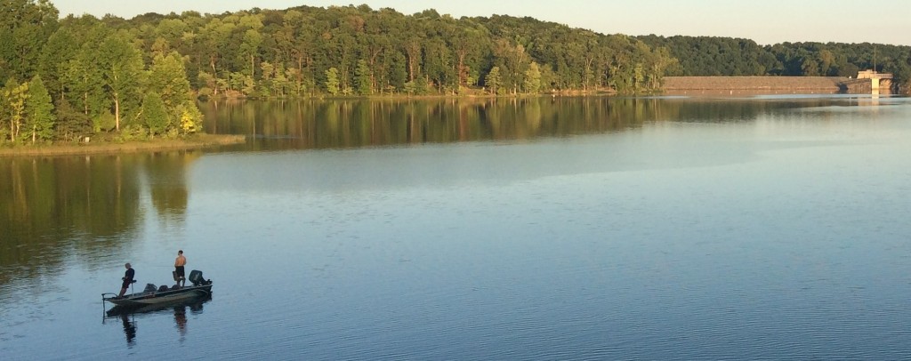
Little Seneca Reservoir holds several wetlands, trails, and other amenities. It is a good example of the many things for which we rely on the Potomac and its resources.
The committee also discussed some stakeholder interest areas that should be better represented, and added additional areas of concern that should be addressed by the plan. The committee also reviewed their initial input into a project vision statement and broke into small groups to identify a vision of desired conditions in 50 years and the role the comprehensive plan can play in meeting those goals.
The process is off to a good start, with an energized advisory committee and a general agreement that this planning process can provide valuable assistance for the region’s waters in sustainably meeting the many current and future demands on the resource.
With the assistance of the stakeholders, ICPRB is now in the process of finalizing the list of challenges and beginning to develop recommendations to be refined by the stakeholders groups. The plan document will then be written and reviewed.
How the plan will finally be used will largely be up to the jurisdictions and agencies of the watershed, which can benefit from a basin-focused plan that identifies common problems and solutions, as well as reducing the chance for interstate resources conflicts.
Unlike many studies that do little more than collect dust on a shelf, the basin comprehensive plan has from its inception been designed to be inclusive and transparent. Its potential users have been a part of the process, and will more likely be motivated to use the recommendations that they helped develop.
“The comprehensive plan will serve as a roadmap to a sustainable future,” said ICPRB Executive Director Carlton Haywood. “Handing healthy, useful rivers and streams to future generations is one of the highest callings of the Commission,” he said.
Want to learn more or be added to the email distribution list? Visit our website, or contact us with additional questions.
Festival del Río Anacostia
When it comes to learning about local environmental issues it is important that everybody has a seat at the table (or on the boat). That was the thought behind the recent Festival del Río Anacostia held on October 15, 2016, at Bladensburg Waterfront Park in Bladensburg, Md. The riverfest with a Latin twist brought 200-300 watershed residents to the park, where local watershed groups, including the Interstate Commission on the Potomac River Basin, discussed river health, pollution, fishing, and more with the largely Spanish-speaking attendees.
“The Festival organizers wanted a fun environmental event that would be language- and family-friendly for the many Latino residents of the Anacostia watershed. Our overall goals were to inform Latino communities of environmental issues that affect their lives, of outdoor recreation opportunities, and to involve them in the protection of the watershed,” noted Rebecca Wolf of the Interstate Commission on the Potomac River Basin, one of the organizers of the event.
Dedicated to connecting the Latin community to the Anacostia, each organization had a Spanish-speaking attendant to help with translations and explanations. Free fishing lessons and boat-rides let people experience the sights, sounds, and smells of the river. Each booth had an activity for the young attendees, Marimba dancers entertained the crowd, and many enjoyed tacos and pupusas while perusing the booths.
It is no secret that the Anacostia River has struggled with the effects of urbanization. It is one of the most densely populated watersheds within the Chesapeake Bay region. The high population upstream has contributed to stormwater runoff, trash, and other pollutants in the waterway east of the Nation’s Capital. However, recent years have seen much improvement. Local non-profits and government organizations have worked to increase aquatic vegetation, clean up trash, and institute other restoration efforts as well as increase recreation opportunities for those that live within its watershed.
The first annual event was declared a success by all. Mark your calendars for Festival del Río Anacostia, 2017 on October 15. “After the success of this year’s pilot festival, the event organizers plan for a bigger festival next year,” said Wolf.
ICPRB would like to thank all the organizations and the volunteers that made the Festival del Río Anacostia a success.
Watching the River Flow
The Potomac has always been known as a “flashy” river, with high and low river flows that sometimes are only a few days apart. It earned its title this spring and summer. There was plenty of precipitation during the summer, although the region did not get the massive storms that cause serious flooding. From March through October, the highest daily flow measured at Little Falls gage (which captures flow in the basin upstream of Washington, D.C.) was about 20.9 billion gallons per day on May 8, 2016. The gage recorded a low of about 565 million gallons per day on September 19. Average annual flow of the river is about 7 billion gallons per day. Flows are tracked by the U.S. Geological Survey at gage stations around the watershed. During that time, flows rose and fell frequently from May through August.In the tidal Potomac, there were reports of remarkable water clarity in some areas, although the river as a whole looked fairly normal. The frequent rains also limited sunlight, and submerged vegetation in the river got off to a very slow start in the spring, but quickly recovered to normal or above-normal levels.
The mouth of the Potomac is near the southern end of the annual “dead zone” of low-oxygen (hypoxic) water that infests part of the Chesapeake’s bottom each summer. The Potomac has its own warm-weather hypoxic zone that is present at the mouth and can extend up toward the Route 301 Bridge in bad summers. Like the bay, the lower Potomac’s zone was about normal for the year after bouncing around the median. Bottom dissolved oxygen near the river’s mouth approaches zero in many years.
When an extended dry spell gripped the basin in September, river levels fell to a point where the ICPRB Section for Cooperative Water Supply Operation on the Potomac (CO-OP) began daily monitoring of river levels, water supply utility demands and precipitation. The daily status monitoring allows a smooth transition into drought operations, if needed. In a strong drought, CO-OP works with the utilities to guide their use of water sources and to request releases of stored water from the Jennings Randolph Reservoir, more than 100 miles upstream. Daily monitoring occurred during the month of September. River levels rose in early October, but monitoring began again on October 24, and has been ongoing. Water usage drops strongly in the fall (after people stop watering lawns and gardens) and even with continued dry weather the probability of a water release is very small.
Students and educators in the Potomac River basin are lucky to have a myriad and diverse number of groups in the area that provide support for environmental education. The Interstate Commission on the Potomac River Basin is offering a new way to connect educators to these important local organizations. The Environmental Resource Directory is a database for educators to find organizations in the Potomac River basin that can provide field experiences, professional development, funding and more.
The easy-to-use search feature allows teachers to search by focus area (water, air, nature, money, landscape design, waste) or by service provided (curricular resources, school-based presentations, field experiences, professional developments, community services, technical expertise, funding). So whether an educator is looking to augment their classroom instruction, meet a Meaningful Watershed Educational Experience (MWEE) requirement, or looking for continuing education opportunities, this is the place to find them. A teacher can search for exactly what he or she needs, whether it is inside, or outside, of the classroom.
In addition to the Environmental Resource Directory, ICPRB offers a variety of Educator Resources for those in the Potomac River basin and beyond, including lesson plans and professional development workshops that address Environmental Literacy, Next Generation Science, and C3 Social Studies Framework for Inquiry. Feel free to contact us for more information on any of these great programs.
The EPA has named the source of the spill as the NRG Power Plant in Dickerson, Md. The sheen has been identified as an oil used in the turbines of the power plant. Officials state that less than 150 gallons were discharged into the Potomac River. An EPA spokesperson said that the spill amount was determined by NRG’s assessment of how much oil could not be accounted for.
Current focus is on cleanup and recovery operations. The EPA has requested that NRG Power provide a team to sufficiently provide “an aggressive shoreline cleanup program from the NRG plant down to Whites Ferry” as well as additional cleanup efforts downriver where sheen was observed.
Drinking water is safe and protected. The sheen is still visible in limited areas downriver. Water utilities still affected are keeping protective booms in place to prevent the substance from entering their intakes and performing additional testing. All water utilities are reporting safe drinking water.
Update Thursday, November 1, 2016
A multi-state multi-agency team continues to look for the source of an oil-like sheen on the Potomac River downstream of the confluence with the Monocacy River. The ICPRB has been using its time-of-travel river spill model to provide information to help drinking water suppliers to protect their facilities. The model effectiveness has been of limited because of the lack of data about the spill, including its location, volume, and duration. The model also assumes a contaminant that is mixed into the water, rather than floating on the surface. Lab results due on Friday should help identify the substance. All drinking water facilities are operating, safe, and protected.
11:30am, November 29, 2016
A sheen on the water surface of the Potomac River near Point of Rocks, Md. was first reported by authorities on Sunday, November 27. State and federal agencies, water suppliers, and the Interstate Commission on the Potomac River Basin are responding to the contamination. Metropolitan water utilities are taking extra steps to protect drinking water supplies, and safe water delivery is continuing without problems.
State and federal agencies are ascertaining the exact extent of the contamination. The source and the material are unknown, as well as whether the event has stopped or is continuing. Initial samples indicate a hydrocarbon of some kind, perhaps a heavy lubricating oil. More detailed results are expected soon.
In addition to coordinating spill communications among state and federal authorities and water suppliers, the Interstate Commission on the Potomac River Basin (ICPRB) is helping track the progress of the unknown substance down the river. Staff at ICPRB are utilizing the Emergency River Spill Model to provide approximate arrival times to water intakes downstream. During a spill event, the Spill Model provides estimated time of arrival, maximum contaminant concentration, and the time the contaminant is expected to be past the water intake. The lack of information about the event makes modeling the spill difficult.
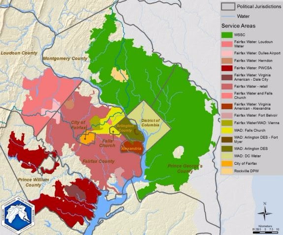
Some water suppliers such as Fairfax Water and the Washington Suburban Sanitary Commission (WSSC), have shut down some intakes during this time. Fairfax Water and the Metropolitan Washington Council of Governments also have issued press releases.
Visit our website to learn more about ICPRB’s role in spill response, including spill protection planning and spill emergency response.
This article will be updated as new information becomes available.
ICPRB’s Score Four Program makes headway in Prince George’s County, Md.
Maryland has more than 10,000 miles of rivers and streams—spanning from the Appalachians to the Eastern Shore—each being of vital importance to the Chesapeake Bay. Our treasured waterways range from small, unnamed creeks in our neighborhoods to the grand Potomac River. They serve as habitats for species that are important to maintaining a healthy ecosystem and provide essential natural services to our environment. We depend on our waterways to help grow our crops, feed our reservoirs, and provide food, drinking water, and recreational activities. The value they provide is of great importance. It is imperative that we keep our streams healthy because the water, life, and pollutants in them eventually flow into larger rivers and the Chesapeake Bay. The quality of the Bay is dependent upon the quality of our streams.
Unfortunately, only 20 percent of Maryland streams meet the criteria for “good” condition. Most streams have eroded stream banks, are polluted and filled with sediment and litter, and lack an abundance of wildlife. With 80 percent of our streams in poor or fair condition, we should all work to protect them and to improve their water quality. This past school year, students in Prince George’s County, Md. did just that. More than 400 students removed approximately 700 square feet of turf grass and replaced it with gardens containing more than 200 native trees and plants that increase infiltration and absorption of runoff, reducing the amount of pollution that enters their local streams.
During the 2015-2016 school year, three Prince George’s County public high schools participated in ICPRB’s Score Four: Students, Schools, Streams, and the Bay program, led by ICPRB educators Rebecca Wolf and Nguyen Le. These schools included the Academy of Health Sciences at Prince George’s Community College in Largo, Northwestern High School in Hyattsville, and Parkdale High School in Riverdale. The Score Four program leads students through the process of exploring their watershed and assessing their school campus in order to develop a Stormwater Action Project aimed at reducing stormwater pollution to local streams.
Students began the year exploring their watershed by researching their local stream and learning about stormwater pollution sources and reduction methods. They were excited to discover that their local stream was within walking distance of campus and learned what they could do to improve its quality. During their research, they learned about the negative correlation between impervious surfaces and stream quality; the higher the amount of impervious surfaces, the lower the stream quality. Impervious surfaces do not allow water to infiltrate into the ground. Stormwater runs directly into storm drains, carrying trash and other pollutants into the stream or river, eventually making its way to Chesapeake Bay.
In the next phase of the program, the students assessed their campus by performing scientific inquiries to determine how their campus contributes to stormwater pollution. These inquiries helped students understand key concepts related to stormwater issues on their campus that would assist them in developing their project. They conducted a campus assessment to identify stormwater paths, problem areas, and possible locations for their project. They also investigated the permeability of the school grounds, as well as soil percolation and composition. With this data, the students determined their secondary project goals and project site, then selected native plants and created a design for their garden. Through this process, the students were able to tailor a project to their individual school campus.
At the Academy of Health Sciences, social studies teacher Carmen Wright and biology teacher Apollo Cordon, envisioned installing a conservation landscape on campus. A conservation landscape reduces stormwater runoff while beautifying the campus and attracting wildlife, such as beneficial insects and butterflies. After performing research, collecting data, and selecting plants, the students used their creativity and math skills to develop potential designs for their garden. Teams of students created 30 potential designs. The students presented their designs to their classmates and used a scoring rubric to judge each design, with the highest scoring design from each class entered into a design contest. Students then voted for the winning design. The final design for their garden centered on an eastern redbud tree as the focal point surrounded by butterfly milkweeds, New England asters, black-eyed Susans, and Joe-Pye weeds, totaling more than 60 plants. Bright orange blooms of butterfly milkweeds with plentiful monarch butterfly caterpillars greeted the students upon their return this fall.
Kari Rowe, an ESOL (English for Speakers of Other Languages) teacher from Northwestern High School, also envisioned a conservation landscape on campus. In the beginning of the program, it was difficult for the students to fully understand the concepts. However, despite the language barrier, the program was able to be adapted with guidance from Ms. Rowe. By the end, the students displayed their understanding and confidence through the success of their garden. The students designed the garden in a classic “bean” shape, planting more than 60 shrubs and perennials. The garden transformed the area with beautiful blooms of blazing stars, black-eyed Susans, and vibrant purple berries on their beautyberry bush.
Environmental science teacher Malka Ostchega had different visions for her students at Parkdale High School. She envisioned installing the beginnings of a food forest on campus that would continually develop throughout the years. Her students researched edible native plants that would meet their site conditions. They planted more than 70 trees and shrubs, ranging from persimmon trees to blackberry bushes to blueberry bushes, on a large hill near the entrance of the school. By selecting to plant on the hill, the food forest is optimally placed to reduce runoff.
At the conclusion of the program, the students celebrated their efforts and their gardens, taking great pride in what they accomplished. One student described how she valued implementing a project to address the problem of stormwater pollution instead of just vaguely talking about how we can help the environment. The students became environmentally knowledgeable and felt driven to continue to make a difference in protecting the valuable assets of Maryland’s landscape.
The success of this program was dependent on the cooperation, hard work, and dedication of the students, teachers, partners, and sponsors. Thank you to the Prince George’s County Department of the Environment and Chesapeake Bay Trust for providing funding through the Prince George’s County Stormwater Stewardship grant program.
You can watch a VIDEO on the Parkdale High School students journey through the Score Four program.
Flow at the Point of Rocks gage has risen to over 2000 cfs, the threshold for daily monitoring. Daily monitoring will be called off until further notice. Learn more…
Newsletter Subscription
Stay informed about the latest news, impactful projects, environmental challenges, and community initiatives in the Potomac River watershed—sign up today!