News

Entry Thumbnail

About the Basin: Little Bennett Regional Park

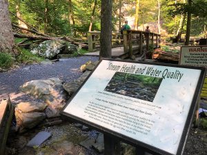
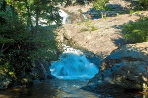
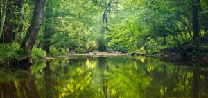
A calm stream surrounded by trees at Little Bennett Regional Park.

Photo from MNCPPC

If you take MD-355 north out of Washington, D.C., you will drive through miles of urban and suburban landscape. Eventually, the houses and shops will turn into bucolic fields and forests. The gateway to this beautiful part of rural Maryland is Little Bennett Regional Park in Clarksburg, Md. The south side of the park is lined by housing developments named for the farms that once stood there, but pass through the park and Maryland becomes agricultural fields and small towns.

Just as it is the gateway from urban to rural, Little Bennett also inhabits the ambiguous space between the past and the present.  The park boasts 14 historic sites and 25 miles of forested hiking trails, but it also has a golf course, playgrounds, and more-than-adequate facilities for both glampers and campers.  At 3,700 acres, there is a lot to do and see at Little Bennett.

Eastern bluebirds and timberdoodles are just some of the notable wildlife in the park. If you see a large mound of dirt, admire the handiwork from afar but do not touch it. Those mounds are home to Allegheny mound-builder ants. They can become aggressive if disturbed.

The park’s historic sites celebrate the agricultural and small-scale industries that covered Montgomery County, Maryland in the 18th, 19th, and 20th centuries. One of the 14 historic sites is a one-room schoolhouse built in 1893 and restored to its original appearance in the 1920s. Join park staff on the first Sunday of the month for a guided tour.

Entry Thumbnail

About the Basin, Peculiar Potomac Edition – George Washington’s Bathtub

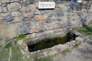
George Washington’s Bathtub

George Washington’s Bathtub in Berkeley Springs, West Virginia is touted as the “only outdoor monument to presidential bathing.” However, (spoiler alert!) Washington never actually used the tub. The stone “bathtub” was built to symbolize the bathing conditions of the 1700’s. In his quest for better health, Washington visited the hot springs on many occasions.

It is unclear how effective the the hot springs were. In a letter from 1761, Washington said, “I think my fevers are a good deal abated, though my pains grow rather worse, and my sleep equally disturbed.” Washington enjoyed the hot springs frequently, despite his disturbed sleep. He even bought a property close by in the appropriately named town of “Bath”. The town continues to be a popular destination for a spa retreat.

At less than 5 acres, the stone structure in the shape of a bath is located in one of the smallest parks in the West Virginia State Park system. Nonetheless, the park boasts a museum, a Roman bathhouse with spa services, and a public drinking fountain. People come from miles around to fill jugs with the natural spring water.

There is a yearly celebration of the unusual monument, known as George Washington’s Bathtub Celebration, held in mid-March. But if you can’t wait that long to explore this roadside attraction, check out the most famous (and only) presidential bathing monument this weekend for the monthly Art in the Park at Berkeley Springs Park on Sunday. You can support local artists while you explore the curious sites the Potomac watershed has to offer.

Do you know a spot in the Potomac watershed that is wacky, curious, or just a bit odd? Let us know by emailing info@icprb.org and it may be featured in a future Peculiar Potomac Edition of About the Basin.

Entry Thumbnail

About the Basin – Green Ridge State Park

Green Ridge State Park

About the Basin has featured many luxurious camping spots; large, resort-style houses in state parks (read: Westmoreland State Park) and glamping with all the amenities (read: Cacapon State Park). The park in this About the Basin offers a different take on camping. A 4WD car is recommended, the most luxurious items you will find are a picnic table and a fire ring, and park staff offer A LOT of advice on bears. It is basic, bare-bones, rustic camping. It is Green Ridge State Park in Flinstone, Md.

Although camping amenities may be limited, the options for entertainment are not. As the largest contiguous block of public land, Green Ridge has a lot to offer. There is hunting, fishing, and a shooting range for the sportsmen among us. The 50+ miles of hiking provide many camping opportunities for avid backcountry backpackers. The hiking trails seem limitless, as many connect with Buchanan State Forest and the Chesapeake and Ohio National Historic Park Trails. A 12-mile mountain bike trail, geocaching, and paddling are also an option for recreation. There is even a canoe campsite available on a first-come, first-served basis. Some of these activities require permits, so make sure to stop by the visitor’s center before hitting the trails. A detailed map is available (and recommended, since cell service is spotty).

All of this is only a 2-hour drive from the DC Metro area. If you are looking for a rustic weekend away, Green Ridge State Park is where it’s at.

Entry Thumbnail

About the Basin – Westmoreland State Park

Westmoreland State Park

Westmoreland State Park is located along the shores of the Potomac River in Montross, Virginia. The park was one of six Virginia State Parks that opened in 1936 through the Civilian Conservation Corp program. Many of the park’s roads and trails were built by hand during that time.

Westmoreland is about a 2-hour trip south of Washington, D.C., and it is worth the drive. But don’t just go for a day, stay for a night or two. Better yet, stay for three nights. That is the only way to experience all this park has to offer.

Grab a Discovery Pack filled with identification guides and sieves from the visitor’s center and head down to the beach to try your luck at dinosaur hunting. Fossilized shark teeth are a common treasure found on Westmoreland beaches.

But that’s just day one. After you’ve gathered up all your shark teeth, join park staff for a variety of classes for the young and the young at heart. A fossil hike along the beach provides an introduction to the ancient history of the Potomac River. A program on crabbing will introduce you to crabbing techniques used by watermen on the Potomac. They also offer classes on ice cream making, sharks tooth necklace making and more. Join them for their next Fossil Hike on May 26. The park also participates in Clean the Bay Day on June 2 with a large, organized cleaning effort of the park and its beaches (or find a location closer to home to join Clean the Bay Day efforts).

Exhausted from your day of dinosaur chasing? The park offers everything from basic tent camping to luxurious cabin glamping and everything in between. Did you bring the in-laws, the grandkids, and all of their friends? The waterfront Potomac River Retreat sleeps 16  with 5-bedrooms and 5-baths.

There is something for everyone at Westmoreland State Park. When you go, share photos on social media with #PotomacLove and show us how you are enjoying the river this summer!

Entry Thumbnail

ICPRB Commissioners Encourage Water Planning

Strong regional planning has provided the metropolitan Washington Area with a reliable supply of drinking water for decades. Regional growth and climate issues spurred an important study that examines how the region might supplement water supplies for the future of the region. The report assesses a range of new management protocols, storage, and technology.

The Commissioners of the Interstate Commission on the Potomac River Basin (ICPRB) recently passed a resolution commending the Washington Metropolitan Area Water Supply Alternatives Study, and encouraging area stakeholders and water managers to work together to implement the study’s recommendations.

The study, performed by the ICPRB Section for Cooperative Water Supply Operations on the Potomac (CO-OP), assesses a range of solutions to increase the capacity of the region’s water supply, which may not meet unrestricted demands under all conditions by 2040. The study provides information on alternatives to ensure reliable drinking water supplies over a planning horizon extending to 2085. Alternatives were evaluated by their abilities to maintain a reliable water supply that includes growing metropolitan area water demand, decreasing river flows due to upstream use, and the potential impacts of climate change.

“The Commission encourages regional and federal stakeholders, planners and policymakers to review the report’s findings and strongly consider implementation of recommended options.  The Commission is committed to continuing its role in facilitation of this process between the multiple stakeholders where it has the authority, resources and relevant expertise,” the resolution noted.

###

Entry Thumbnail

Potomac Basin Reporter, Winter 2017

Potomac Basin Reporter Title Image

IN THIS ISSUE

Ahoy, Ship of the Potomac!

Archaeologist inspects the historic ship. Courtesy of Alexandria Archaeology, Alexandria, Va.

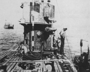
What does a chunk of coral from the Caribbean Sea, a brick sidewalk, two outhouses, and a 200-year old ship have in common? They were all found in the recent excavation for the parking garage of the Indigo Hotel in Alexandria, Va. At one point these items were above the waterline of the Potomac River. However, a few decades after the city of Alexandria was founded in 1749, the riverfront landowner wanted to increase his property so he did something that was pretty common back then, he just filled in the river bank. Known as “banking out”, the landowner sometimes scuttles, or sinks, an old ship in the spot to help contain the new materials added to the riverbed. That is believed to the be the case for the 50-foot ship fragment found in this soon-to-be parking garage.

The ship was painstakingly excavated from the pit in January 2016 by Thunderbird Archaeology. The wood needed to stay wet to prevent additional deterioration so the pieces were placed in large water tanks in a city facility for storage and protection. Little is known about the actual ship. Researchers are hoping that its restoration will unveil some of its secrets, including its construction, history, and possibly even the crew. Preliminary research has revealed that the ship’s timber was felled in the state of Massachusetts sometime after 1741. Based on historic maps, it is thought that the ship was buried on the Potomac shoreline between 1788 and 1798, along with sand, rocks and other debris.

After requesting proposals from professional conservationists around the world, the City of Alexandria’s Archaeology Department put the ship into the hands of experts at Texas A&M University’s Center for Maritime Archaeology and Conservation (TAMU).

In preparation for its cross-country voyage, each beam of the ship was meticulously documented, examined, photographed and measured. All hands were on deck for this painstaking process. Each historic piece was wrapped in a wet paper-towel material, followed by plastic-wrap, then a layer of foam padding. Over 1.5 miles of foam padding were used to protect the precious cargo. When completed, the floor of the storage facility seemed to be covered with Egyptian mummies of all shapes and sizes.

TAMU will spend an extensive time documenting each piece of timber, creating a laser scanned image of each beam that can be used for further research. “We hope to learn about the ship’s construction methods and original size and appearance”, said Dr. Eleanor Breen, the acting City Archaeologist working on the project. TAMU will conduct a 2-step restoration process. Initially, the water will be slowly replaced with polyethylene glycol (PEG) to stabilize and strengthen the delicate planks. Finally, a freeze-drying procedure will remove any remaining moisture.

It may be 5 to 6 years before the ship’s homecoming, but the work for its return has already begun. “The ship is poised to be the anchor for a new waterfront historical interpretation of Alexandria’s maritime heritage,” claims Breen. The display is destined to be a figurehead of Alexandria’s maritime history.

To learn more about the ship and its restoration adventures, follow the Alexandria Archaeology Museum on Twitter at @AlexArchaeology or the hashtag #SaveOurShipALX. A Save Our Ship Fundraiser has been established to preserve this precious piece of history for future generations.

What the Future of our Water Supply Might Look Like

A map of areas served by WMA Suppliers as of 2014

When residents of the Washington metropolitan area turn on their taps, potable water comes out. That it is a largely thoughtless practice is a testament to decades of careful planning and cooperation among area water suppliers assisted by the Interstate Commission on the Potomac River Basin (ICPRB). The commission’s Section for Cooperative Water Supply Operations on the Potomac River (CO-OP) studies water use in the region, organizes coordinated utility operations during extreme droughts, and assesses the reliability of current and future raw water supplies. The ICPRB also helps basin water suppliers protect the region’s drinking water sources.

A new CO-OP study is proposing a range of solutions to increase the capacity of the region’s water supply, which could fail to meet unrestricted demands by 2040. In this case, there would be a small probability of failure if no action is taken to reduce water use during an extreme drought. The study, “Washington Metropolitan Area Water Supply Alternatives,” also provides information on options for a reliable water supply out to 2085. Alternatives have been evaluated according to their capabilities to increase future system reliability in the face of growing metropolitan area demands, decreasing river flows due to upstream consumptive use, and the potential impacts of climate change.

The options for augmenting future supply are both structural and operational.  Many have been the subject of past investigations by metropolitan area water suppliers. Although most of the structural alternatives (for example, conversion of stone quarries to store water from the Potomac) would provide water directly to only one or two suppliers, all would provide regional benefits by reducing Potomac River withdrawals during times of low flow. All structural alternatives would require significant investments in new infrastructure including new underground conduits to transfer raw and/or treated water from one part of the supply system to another. The operational alternatives would require little or no infrastructure investment. They would instead require new cooperative agreements, and/or contracts between water suppliers, and/or investment in research to develop new operational tools and policies.

In general, the study found that combinations of structural and operational alternatives should be in place to ensure system reliability in the future. For the medium-term planning horizon of 2040, two strategies for phased implementation of quarries and operational enhancements were recommended for further refinement. These two combinations of alternatives were selected in part to ensure system reliability under a moderately severe climate scenario with a 7 percent decrease in average summer stream flows.

The strategies also consider the need for steps toward broader regional cooperation to help prepare for more severe challenges that may occur in the decades after 2040. Over the longer-term planning horizon, by 2085, study results indicate that most of the proposed alternatives will be needed to ensure future reliability.

“This is the next step in keeping the area’s water supply able to meet the demands of residents,” said ICPRB Executive Director Carlton Haywood. “The region’s water supply will maintain its very high level of reliability with proactive planning and actions by the water providers and governments. This level of planning, cooperation, and execution is why we are looked upon as an example by other regions,” Haywood said.

American Shad, Striped Bass Show Good Recruitment this Year

A map of areas served by WMA Suppliers as of 2014

American shad and striped bass stocks had good spawns in the Potomac during 2017. Maryland’s annual young-of-the-year survey consists of seine net hauls at 22 locations around the Maryland portion of the Chesapeake Bay to gauge how many fish were hatched after the springtime spawn. The survey is an important tool in measuring the health of Chesapeake Bay and tidal river fisheries.

This year’s survey showed encouraging numbers for both striped bass and American shad. Many areas of the bay contributed to the striped bass number, while American shad reproduction came almost entirely from the Potomac.

Overall, bay-wide numbers for both the species were improved over a poor 2016. Maryland Department of Natural Resources Fisheries Biologist and manager of the young-of-year survey Eric Durrell noted that spring weather conditions, including river flow, water temperature, and other factors heavily influence the success of migratory fish species such as the striped bass and shad. The fish time their runs upriver based on these conditions, which give the eggs and larvae the best environmental conditions for success.

Striped bass in the Potomac were near the long-term average. American shad were well above the long-term average on the Potomac, and should help buoy stocks after a phenomenal 2015 Year Class. The same could not be said for the rest of the bay, where reproduction was minimal. “We caught 1,093 American shad during the survey,” Durrell said, “And 1,004 of those fish came from the Potomac.” He noted that the river has historically spawned a lot of shad and that the modifications of Little Falls Dam restored miles of historical spawning and nursery habitat for the fish. In the upper bay, The Susquehanna has several dams that limit the kind of habitat the fish needs, Durrell said.

The Potomac has benefitted from an ICPRB organized coalition of government agencies, nonprofits, schools, and teachers who played a role in aggressively stocking the river for about 10 years and pushed for the modifications to the dam that reopened about 10 miles of the fishes’ habitat. The project is one of the success stories of the Chesapeake Bay cleanup. Read more about the project online.

American shad reproduction has not been going well on the James and Rappahannock rivers in Virginia, despite a multi-year stocking effort that has, at times, used eggs taken from Potomac fish. A lack of progress toward goals and budget considerations have curtailed the stocking efforts on those rivers.

More information on the juvenile striped bass program and the more than 100 species of fish that are seen during the effort is available online.

The Past, Present, and Future of Potomac Aquatic Plants and Why they Matter

A map of areas served by WMA Suppliers as of 2014

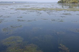
For many people, a boat trip or walk along the shores of the metropolitan Potomac includes seeing a lot of aquatic plants (as well as some algae). Many sections of the Potomac support lush grass beds during the warm months. This has not always been the case, and the growth of submerged aquatic vegetation (SAV) has both signaled and been a major factor in the improved water quality of the river. The resurgence of many species of SAV during the last four decades points to the river’s revitalization, noted Nancy Rybicki, a U.S, Geological Survey scientist who has monitored Potomac aquatic plant growth during that time.

Rybicki periodically updates groups about the river’s plant status, as she did recently at a meeting of the Friends of Dyke Marsh. The packed room was given a history lesson, as well as warnings about water chestnut, an aquatic plant that once crowded the river downstream of Washington, then was eradicated, and has recently reestablished.

Rybicki’s focus over the years has been the upper tidal Potomac. The lower Potomac has not fared as well. The saltier lower river still suffers from water clarity and low dissolved oxygen issues, and is more strongly affected by Chesapeake Bay water quality issues.

The Potomac’s plant populations declined significantly from nutrient and sediment pollution and accompanying algal blooms through the 1930s but massive water chestnut stands downstream of Washington remained. Unlike other aquatic plants, the rooted water chestnut lives on the water’s surface where it can get the sunlight it needed to flourish, despite the sediment and pollution. By 1933, 10,000 acres of dense water chestnut beds clogged the river from Washington, D.C. to Quantico, Va. The growth was finally controlled by a multi-year harvesting and eradication effort by the U.S. Army Corps of Engineers that ended in 1945. Removal by hand continued until at least 1965.

Sewage treatment has improved greatly beginning in the 1970s, resulting in some water quality improvements. About 1983, some vegetation returned to the metropolitan river. Monitoring revealed that the plants were hydrilla, a non-native plant often mistaken for the resident plant elodea. They can be distinguished by the number of leaves that encircle the stem―elodea has 3 leaves while hydrilla has 4-5 leaves per whorl, giving the plant a bushier look. Based on hydrilla management schemes in Florida, which was spending millions of dollars a year, the ICPRB brought groups together to assess the issue. Eventually, an intergovernmental group started mechanically harvesting the plants in areas with high boat traffic.

Although not a native plant, hydrilla stands helped improve water clarity, and hydrilla was followed by a number of other, native, aquatic plants that returned to the river. Hydrilla remains the most common plant, but now shares the river with about 20 other species of plants. Learn to distinguish some of the most common species in the article below. Both the amounts and diversity of aquatic plants increased 10-fold from 1990 to 2007, and continues to increase, Rybicki noted. The growth of Potomac plant populations in a fragile but improving Potomac during that time has been uneven, with weather conditions in any given year (stormy springs with reduced sunlight, high flows that scour the river bottom, cooler temperatures, and other factors) promoting or reducing plant growth.

The growth of aquatic plants in the Potomac has helped improve water quality, helping make the river habitable to more plants, as well as providing food, cover, and water clarity that supports more fish and other creatures in the Potomac ecosystem.

Common Plant Species Found in the Potomac River

The metropolitan Potomac River, devoid of aquatic plants in the late 1970s, saw the return of both native and invasive plants in the following decades. Plant populations in the river grew by a factor of ten from 1990-2007.  More than 20 species of plants now call the river home, these include:

Photo of Hydrilla by David J. Moorhead, University of Georgia, Bugwood.org Hydrilla (Hydrilla verticillata): is an invasive plant that was one of the first to appear in the river’s resurgence of plants in 1981, remains the most common species on the river. It grows in dense beds and can be found in both the fresh and tidal waters. (Photo: David J. Moorhead, University of Georgia, Bugwood.org)
 Valisneria Americana, Photo by Gary P. Fleming, DCR-DNH Wild celery (Vallisneria americana): is a native plant that is an important food source for birds. (Photo: Gary P. Fleming, DCR-DNH)
 Eurasian Watermilfoil photo by Wisconsin DNR Eurasian watermilfoil (Myriophyllum spicatum): is a non-native plant favored by Potomac sport anglers. Its feather like leaves make it less dense than stands of other plants, allowing anglers to penetrate the beds with lures and catch fish. (Photo: Wisconsin DNR)
Coonstail photo by Paul Skawinski, 2009 Coontail (Ceratophyllum demersum): also known as hornwort, has slender, densely branched stems. It does not put roots into the river bed, but lives as long strands anchored by other plants or structure. It spreads mainly through segments of plant breaking off and floating to new areas. (Photo: Paul Skawinski, 2009)
 Elodea canadensis by Christian Fischer, CC BY-SA 3.0, https://commons.wikimedia.org/w/index.php?curid=4870689 Waterweed (Elodea canadensis): is a native plant that looks a lot like hydrilla. It is primarily found in fresh water, but can tolerate some salt and is found in the tidal Potomac as well. (Photo: Christian Fischer)
 Heteranthera dubia - Grassleaf mudplantain Photo by Fritz Flohr Reynolds Water stargrass (Heteranthera dubia): is a native plant with grass-like leaves and sprouts small yellow flowers later in the summer. The plant is found mostly in the freshwater river, but has been extending its range into the upper tidal river. (Photo: Fritz Flohr Reynolds)
Water chestnut (Trapa Natans): has only recently become an issue on the Potomac, but may be spreading from stormwater ponds into the river. If you see it, report it! See the article above for more information.

Quiz Results

In the last Potomac Basin Reporter, we challenged your knowledge of the river with our quiz:”How much do you know about the Potomac River?”
We were impressed with the results! There are a lot of Potomac River experts out there. We thought the questions would be difficult, but the average quiz-taker answered 67% of the questions correctly.

It’s not too late to take the quiz! Click here to take it before reading further. Then come back here to compare your results. The most correctly answered question asked to identify how many jurisdictions the Potomac River spans. A whopping 86% of you chose the correct answer of four states (Maryland, Virginia, West Virginia, Pennsylvania) and the District of Columbia. The most difficult question, with only 46% of people answering correctly, was the average number of gallons withdrawn from the Potomac River each day. This includes irrigation, agriculture, residential and all other uses. This number spikes in the hottest months of the summer, but the average daily withdrawal from the Potomac is 486 million gallons, or 736 Olympic sized pools.

ICPRB in the Community

ICPRB employee at a public event

Staffers at ICPRB spent many fun summer days sharing their love of the Potomac River watershed with the residents who call it home. The ICPRB tables shared information on water quality, educator resources, and other information on the basin. Here are just a few of the events they enjoyed:

Festival del Rio – This multi-cultural, bilingual event is designed to give Latinos an opportunity to learn about local environmental issues.

Jones Point Park Event (Alexandria, Va.) – 75 fourth-graders enjoyed a day of outdoor environmental education at this Every Kid in a Park event.

West Va. Science Teachers Association Conference (Wheeling, W.Va.) – ICPRB staff shared our m any educator resources with West Virginia science teachers.

As part of ICPRB’s Score Four program, the high school students celebrated the Conservation Garden installation at Northwestern High School in Hyattsville, Md. Watch the sign dedication ceremony on Facebook.

What’s New Online

Screen shot of the map

Bilingual Educator Resources – Bilingual lessons are available in English and Spanish for ICPRB educational programs.

Washington Metropolitan Area Water Supply Alternatives – This study assesses a range of solutions to increase the capacity of the region’s water supply, which could fail to meet unrestricted demands by 2040.

Water Quality Trends – an online visualization tool to quality assure water quality data, allowing one to quickly evaluate trends using various parameters.

Chessie BIBI – a multi-metric index of stream health applicable to freshwater streams and small rivers across the Chesapeake Bay watershed.

2016 Drought Exercise Report – For over two decades, ICPRB’s CO-OP has been conducting annual drought exercises for the Washington Metropolitan area.

Watershed Activities to Encourage Restoration – simple, low-cost projects that your organization can use to help protect and restore your watershed.

Calendar of Events – Fun events in the watershed!


**The content of this email does not represent the policies of ICPRB or its Commissioners.**

Entry Thumbnail

ICPRB Releases Water Supply Alternatives Study

September 8, 2017

The region’s future demands more drinking water.

Here is how we can get it.

ICPRB Releases Water Supply Alternatives Study

When residents of the Washington metropolitan area turn on their taps, clean reliable drinking water comes out. This daily event, taken completely for granted, is a testament to decades of careful planning, investment and cooperation among area water suppliers assisted by the Interstate Commission on the Potomac River Basin (ICPRB). The investment in planning continues with the release of a report presenting options to increase drought protection for the Washington metropolitan area’s drinking water system, which will become inadequate in several decades.

A new ICPRB CO-OP study assesses a range of solutions to increase the capacity of the region’s water supply, which could fail to meet unrestricted demands by 2040. “Washington Metropolitan Area Water Supply Alternatives,” provides information on alternatives out to 2085 to help ensure strategic options are available over that planning horizon. Alternatives were evaluated by their abilities to maintain reliability in the face of growing metropolitan area water demand, decreasing river flows due to upstream use, and the potential impacts of climate change.

Options to augment future supply are the subject of ongoing assessments by metropolitan area water suppliers. Some of the options include construction of new facilities, such as converting stone quarries to water storage reservoirs that would directly provide water to one or two suppliers. They would provide regional benefits by increasing Potomac River flows during times of low flow. These alternatives would require significant investments in new infrastructure that include new underground conduits to transfer raw and/or treated water from one part of the supply system to another. Other alternatives include better flow forecasting models, changes to how existing reservoirs are operated, reductions in consumptive use, more stringent water use restrictions, and other proposals. These operational alternatives would entail some costs associated with new cooperative agreements, contracts between water suppliers, and

investment in research to develop new operating tools and policies. The study identified combinations of infrastructure and operational alternatives that should be in place to ensure system reliability in the future. For the 2040 planning horizon, two alternative options for phased quarry storage implementation and operational enhancements were recommended for consideration and further refinement. The two alternatives were selected to ensure system reliability for a moderately severe drought with conservative estimates of climate change impact.

Considerations include protecting the region from shortfalls leading up to 2040 and the need for broader regional cooperation to prepare for more severe challenges that may occur in the decades after 2040. Over a longer-term planning horizon, study results indicate that most of the alternatives will be needed to ensure future reliability by 2085.

“This is another step forward in our long term commitment to meet our region’s water supply demands,” said ICPRB Executive Director Carlton Haywood. “Our water supply is reliable  because water providers and regulators comprehensively plan for the region’s future. The level of planning, cooperation, and execution in this area is why we are studied as innovators by other regions,” Haywood said.

The ICPRB’s Section for Cooperative Water Supply Operations on the Potomac River (CO-OP) studies water use in the region, organizes coordinated utility operations during droughts, and assesses the reliability of current and future raw water supplies. The ICPRB also helps basin water suppliers protect the region’s drinking water sources.

The report is being assessed by the area water suppliers, who will soon decide on a course of action. An executive summary and the full report, “Washington Metropolitan Area Water Supply Alternatives” are available on our website. Contact us for more information.

Download a PDF of this news item HERE.

###


Entry Thumbnail

Cacapon Resort State Park, Glamping in West Virginia

About the Basin, September 1, 2017

Photo Credit: thisisbossi, “Cacapon state park”

A scenic 2-hour drive west from the D.C. metro area will land you at a state park that looks more like a resort than a park. Cacapon (pronounced “Ca-cape-un”) Resort State Park,

near Berkeley Springs, West Virginia, is still a state park at heart, though. It boasts a small sandy beach for swimming, paddle boat rentals, serene fishing spots, many hiking trails, and a nature center. However, the park’s additional amenities make a weekend at Cacapon more glamping than typical old-fashioned camping. You will also find an 18-hole golf course, horseback riding, a hotel and conference center, and cabins decked out with all the necessities for a weekend away.

Vintage Postcard of the beach at Cacapon Resort State Park

It’s vintage, unostentatious vibe has visitors returning again and again. One online reviewer said it best: “Stop being pretentious and stay here.” Activities at Cacapon bring you back to the good ol’ days. You can make new friends with a pickup game of basketball, get your family together for a game of beach volleyball or challenge your in-laws on the tennis courts. For the techies that just can’t separate themselves from their phone, the hiking trails abound with geocache treasures.

For something a little special, hike up Cacapon Mountain to an observation deck where you can see West Virginia, Virginia, Maryland, and Pennsylvania in one sweeping view. It is always a breathtaking site, but even more so during leaf peeping season in October.

If you are looking for something a bit more primitive, check out the Sleepy Creek Wildlife Management Area just east of Cacapon Resort State Park. This 23,000-acre park offers 75 basic campsites. Many afford an inexpensive waterfront view of Sleepy Creek Lake. Unlike Cacapon Resort State Park, amenities are few and far between in this area that truly embodies West Virginia’s slogan, “Wild and Wonderful”.

Entry Thumbnail

Dyke Marsh Wildlife Preserve

About the Basin, August 25, 2017

Photo Credit: Flickr, Dykes Marsh, Geoff Livingston

Just down the river from Alexandria, Va., exists 485 acres of marsh, swamp forest and flood plain known as Dyke Marsh Wildlife Preserve. It is an oasis amidst the concrete jungle. It is part of the George Washington Memorial Parkway managed by the National Park Service. The Preserve has an impressive diversity of flora and fauna, including more than 270 species of birds and 300 species of plants.

Many runners, walkers, and bikers enjoy the Mount Vernon Trail, a 17-mile paved path, that winds through the marsh. The Haul Road Trail is short at .75 miles, but provides a look at each type of habitat in Dyke Marsh.

Kayaking, canoeing, and paddleboarding are the primary activities at Dyke Marsh. They allow visitors a more intimate view of the river and the wildlife that calls the area home. Rent a boat at the marina next door, then paddle south along the shore for the short trip to the marsh.

Photo credit: Flickr, Dyke Marsh, Virginia, La Citta Vita

The U.S. Army Corps of Engineers is in the process of restoring the marsh that is currently eroding at an  average of 6 to 7.8 feet per year. Restoration efforts, which include planting native aquatic vegetation, are scheduled to be completed by 2019.

An active volunteer group, Friends of Dyke Marsh, holds a variety of events open to the public, including a bird walk lead by expert birders each Sunday at 8:00am, plus lectures, educational events, and more. Some upcoming events include a talk on September 13 on Wetland Plants by Dr. Nancy Rybicki, a U.S. Geological Survey Aquatic Biologist and a discussion on November 15th about the health of Hunting Creek and area streams by Dr. Kim Mutsert of the Department of Environmental Science and Policy, George Mason University. The volunteer group also actively works to restore the marsh by planting trees and other activities.

Entry Thumbnail

Leesylvania State Park

About the Basin, August 11, 2017

Located along the Potomac River in Prince William’s County, Virginia, Leesylvania State Park has a lot to offer its multitude of visitors. As one online reviewer states, “This gem of a park offers peace and quiet in the middle of the hubbub of NoVA.” Although small, the park offers a range of amenities for those looking to escape the city for a day, including trails, a boat ramp into the Potomac River, visitor’s center, picnic shelters with barbecues, fishing spots, a playground, and more.

(c) Flickr, Mrs.Gemstone, “Leesylvania State Park – PotomacBeach”

A Living Shoreline project is currently in progress at the park to prevent erosion and create a habitat for aquatic plants and animals. This type of restoration project builds up the shoreline using natural materials to create a wetland environment that protects the shore from erosion and provides valuable habitat. There is an informational walk open to the public on September 10 to learn more about the project and the ecological principles behind it.

Having only been open since 1992, the park itself is relatively young. However, the area is full of history, with some spots within the park listed in the National Register of Historic Places. The land was once owned by some of the more famous residents of northern Virginia, the Lee and Fairfax families. Chimneys are all that remain of these notable residences though. A few members are buried in a cemetery within the park. These historic sites are accessible by trail. Learn more about the wartime history of the area on the Potomac River Blockade Boat Tours in September and October.

In addition to the events above, the staff at Leesylvania State Park provide weekly events for people of all ages. Walks, talks, and other adventures explore the wildlife of the area, from the bottom of the ponds to the sky above. If you can’t make it to a scheduled event, park staff are usually on hand to discuss wildlife, fishing spots, or history of the park.