News

About the Basin

Entry Thumbnail

About the Basin, Peculiar Potomac Edition: Waffle Rock

Waffle Rock

About the Basin, Peculiar Potomac Edition

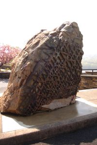
A large rock with a waffle-like pattern on one side. Photo Credit: mdmarkus66, https://flic.kr/p/7WFfUy

Photo Credit: mdmarkus66, https://flic.kr/p/7WFfUy

Last week’s About the Basin covered the Jennings Randolph Lake near Elk Garden, West Virginia. This week’s article takes a closer look at a geological phenomenon known as Waffle Rock. This interesting rock stands guard at the West Virginia Overlook above Jennings Randolph Lake.

This massive rock has a large waffle-pattern on one side. Some have claimed it is evidence of visitors from another planet, some say it is the scale pattern of a ginormous lizard, and others say it is just an interesting geological formation. We’re going with the “geological formation” theory.

Several hundred million years ago, according to ICPRB hydrogeologist, Jim Palmer, “Joints opened up in the soft sandstone and allowed iron rich water to seep into cracks and form cement around sand particles.” This cemented sand is highly weather resistant. Regular sandstone is not. The soft sandstone eroded away from the rock while the grid-like pattern of the hard sandstone remained, creating a waffle-y rock.

The rock was originally part of a larger formation that broke off some point in the past few hundred million years. It ended up near Shaw, West Virginia, the ill-fated town that is now at the bottom of Jennings Randolph Lake. The rock had geological (and, according to the story, sentimental) value. Before the lake was filled in during the early 1980’s, the rock was moved to its final resting place. It now welcomes tourists and locals alike to ponder the deeper things in life while overlooking the scenic Jennings Randolph Lake.

Entry Thumbnail

About the Basin: Jennings Randolph Lake

Jennings Randolph Lake

Less than 3 hours west of the Washington metropolitan area lies a massive man-made lake with a storied past. Tucked into the Allegany Mountains of West Virginia, Jennings Randolph Lake sits over land that was once a small town called Shaw. In 1981, the residents moved out and water moved in.

As part of the North Branch of the Potomac River, these are the source waters for the 5.1 million people in the Washington metropolitan area. In times of drought, the lake serves as an emergency reservoir to many downstream. In addition to water supply, the project was constructed for flood risk management, water quality, low flow augmentation, and recreational opportunities. The dam was constructed, and is still managed by, the U.S. Army Corps of Engineers (USACE).

But Jennings Randolph is more than just a place to store water for thirsty people downstream. The 4,500 acres of land and water is a recreational hub with an impressive variety of activities. These include boating, camping, waterskiing, scuba-diving, hiking, swimming, archery, birding, hunting, whitewater rafting, and record-breaking fishing.

Walleye is regularly stocked in Jennings Randolph. Patience is required though, as they are known for being large, but also wily and difficult to find in the lake. Smallmouth bass, trout, bluegill, and catfish abound.

The Howell Run Picnic Area is a picturesque picnic spot overlooking the lake. It offers several shelters for rent, many picnic tables, trails, bathrooms, fishing, and more.

A trail from the picnic area leads to a swimming spot known as Shaw Beach. This sandy beach is a great place to soak up the rays while the kids play in the water.

A 3D archery course is available if you are looking for more adventures. The course is for both beginners and advanced shooters, but you will need to bring your own bow.

During the spring (and occasionally during the summer), USACE releases enough water from the dam to make Class I, II, and III rapids in an area below the dam known as Barnum Whitewater Area. The release schedule for the year is posted online.

Whether you are looking for a day on the water, a day on the beach, or even bigger adventures, Jennings Randolph Lake has something for everyone.

Entry Thumbnail

About the Basin: Fairfax Stone State Park

Fairfax Stone State Park

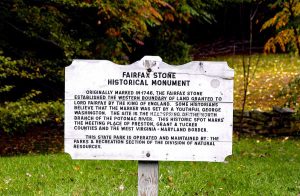
A white, aged plaque that tells the story of Fairfax Stone.

Photo by West Virginia State Parks

Fairfax Stone State Park, near Davis, West Virginia, has no boating, no hiking, and no camping. It does not even have a restroom. In fact, it is a diminutive 4-acre park.  However, it has immense importance to the Potomac River and the history of the region.

A spring, marked by an organized pile of mossy rocks, is the beginning of the North Branch of the Potomac River. A mere 383 miles downriver, that trickle transforms into the 11-mile wide mouth of the Potomac River, spilling into the Chesapeake Bay.

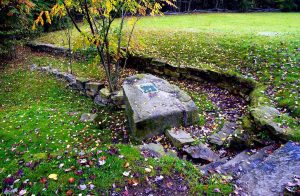
Before the American Revolution, it was the tradition that English kings would reward loyal friends with large parcels of land in the territories. A plaque on a six-ton rock at the entrance of the park commemorates the western boundary of land granted to Lord Fairfax by King Charles II of England in 1746.

A large stone with a plaque that tells the story of Fairfax Stone.

Photo by West Virginia State Parks

His bounty was, “bounded by and within the heads of the Rivers Rappahannock and Patawomecke”. Known as Fairfax Stone, it is one of the oldest markers in the United States. This plot of land has been part of many boundary disputes.

There may not be many amenities in this charming park, but it is a good reminder that even the largest rivers start as a trickle.

Camping and other amenities can be found at the nearby Canaan Valley Resort State Park and Blackwater Falls State Park.


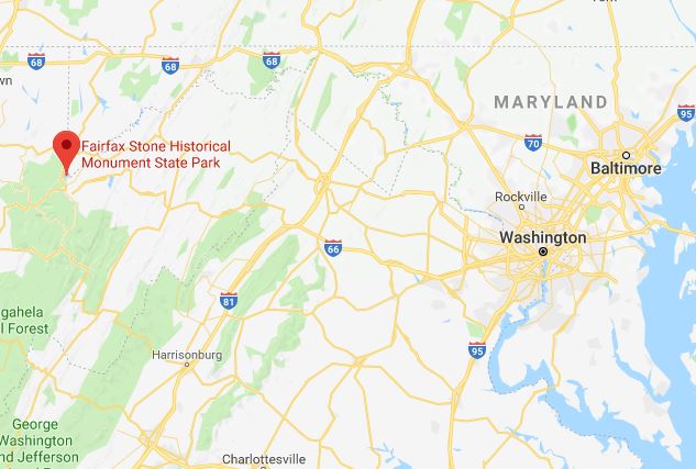
Photo of a map showing the Fairfax Stone state park in the west and Washington, D.C. in the east.

Photo from Google maps.

Entry Thumbnail

About the Basin: Brunswick Family Campground

Brunswick Family Campground

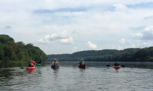
Four kayakers are seen from behind as they paddle down the Potomac River near Brunswick, Md.

Kayakers paddle down the Potomac River from the Brunswick Family Campground boat ramp.

For many families, the Brunswick Family Campground in Brunswick, Maryland is a summertime tradition. Whether you are a hiker, biker, kayaker, history buff, or train enthusiast, there is something for everyone at this campground along the C&O Canal Park.

This campground is known for two things: access to the river and trains. Campers launch from the boat ramp for a paddle down the Potomac River. Organize boat rentals and transportation with camp staff. Some campers park their beach chair in the shallow waters along the edge to cool-off on a hot day.

Train enthusiasts can enjoy the trains that come rumbling down the tracks along the campground throughout the day. Don’t forget your earplugs for the nighttime rumbles! Learn more about the town’s rich transportation history at the Brunswick Heritage Museum.

Plan to spend a few days exploring the area. The historical powerhouses, Harpers Ferry National Park, Antietam National Park, and Monocacy National Battlefield are all an easy drive from the campground.

One of the perks of staying at a campground managed by River & Trail Outfitters is that many of their boating trips launch directly from the boat ramp at the campground. They offer a variety of adventures along the Potomac River, including an upcoming Sunset Float and Moonrise Paddle Tour on July 21. We would like to thank River & Trail Outfitters for their help as “river watchers” for ICPRB’s weekly newsletter, River Watch.

Going out on the Potomac River this weekend? Show us how much you love the Potomac by using #PotomacLove in your social media posts!

Entry Thumbnail

About the Basin, Peculiar Potomac Edition: Foamhenge

Foamhenge

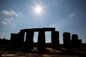
Several large blocks of foam backlit by the sun. They are arranged to look like Stonehenge.

Foamhenge at Cox Farms

In celebration of the beginning of summer, this week’s About the Basin covers an internationally known pile of rocks that honors the summer solstice.  No, not Stonehenge, but the lesser known -henge this side of the pond: Foamhenge.

At Foamhenge, the life-size blocks of foam are chiseled, painted, and arranged to be an exact replica of the slightly-more-famous prehistoric wonder of the world, Stonehenge, in Wiltshire, England. However, this one is closer to home.

Located at Cox Farms, Foamhenge is less than an hour’s drive from the D.C. Metro Area. This homage to Stonehenge is open to the public on Saturdays (12:00-2:00pm) during the summer and spring seasons. Admission to this quintessential American roadside attraction is free but only accessible via a shuttle provided by the farm. Part of the weekly event called “Smokin’ Saturdays”, farm activities also include food, feeding farm animals, produce, and live music. Over-sized games of Yahtzee, Jenga, Connect 4, and Checkers are also available for entertaining the whole family.  This weekend, check out Foamhenge for a European-style staycation and marvel at the wonders that the Potomac basin have to offer right here at home.

Entry Thumbnail

About the Basin: Little Bennett Regional Park

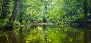
A calm stream surrounded by trees at Little Bennett Regional Park.

Photo from MNCPPC

If you take MD-355 north out of Washington, D.C., you will drive through miles of urban and suburban landscape. Eventually, the houses and shops will turn into bucolic fields and forests. The gateway to this beautiful part of rural Maryland is Little Bennett Regional Park in Clarksburg, Md. The south side of the park is lined by housing developments named for the farms that once stood there, but pass through the park and Maryland becomes agricultural fields and small towns.

Just as it is the gateway from urban to rural, Little Bennett also inhabits the ambiguous space between the past and the present.  The park boasts 14 historic sites and 25 miles of forested hiking trails, but it also has a golf course, playgrounds, and more-than-adequate facilities for both glampers and campers.  At 3,700 acres, there is a lot to do and see at Little Bennett.

Eastern bluebirds and timberdoodles are just some of the notable wildlife in the park. If you see a large mound of dirt, admire the handiwork from afar but do not touch it. Those mounds are home to Allegheny mound-builder ants. They can become aggressive if disturbed.

The park’s historic sites celebrate the agricultural and small-scale industries that covered Montgomery County, Maryland in the 18th, 19th, and 20th centuries. One of the 14 historic sites is a one-room schoolhouse built in 1893 and restored to its original appearance in the 1920s. Join park staff on the first Sunday of the month for a guided tour.

Entry Thumbnail

About the Basin, Peculiar Potomac Edition – George Washington’s Bathtub

George Washington’s Bathtub

George Washington’s Bathtub in Berkeley Springs, West Virginia is touted as the “only outdoor monument to presidential bathing.” However, (spoiler alert!) Washington never actually used the tub. The stone “bathtub” was built to symbolize the bathing conditions of the 1700’s. In his quest for better health, Washington visited the hot springs on many occasions.

It is unclear how effective the the hot springs were. In a letter from 1761, Washington said, “I think my fevers are a good deal abated, though my pains grow rather worse, and my sleep equally disturbed.” Washington enjoyed the hot springs frequently, despite his disturbed sleep. He even bought a property close by in the appropriately named town of “Bath”. The town continues to be a popular destination for a spa retreat.

At less than 5 acres, the stone structure in the shape of a bath is located in one of the smallest parks in the West Virginia State Park system. Nonetheless, the park boasts a museum, a Roman bathhouse with spa services, and a public drinking fountain. People come from miles around to fill jugs with the natural spring water.

There is a yearly celebration of the unusual monument, known as George Washington’s Bathtub Celebration, held in mid-March. But if you can’t wait that long to explore this roadside attraction, check out the most famous (and only) presidential bathing monument this weekend for the monthly Art in the Park at Berkeley Springs Park on Sunday. You can support local artists while you explore the curious sites the Potomac watershed has to offer.

Do you know a spot in the Potomac watershed that is wacky, curious, or just a bit odd? Let us know by emailing info@icprb.org and it may be featured in a future Peculiar Potomac Edition of About the Basin.

Entry Thumbnail

About the Basin – Green Ridge State Park

Green Ridge State Park

About the Basin has featured many luxurious camping spots; large, resort-style houses in state parks (read: Westmoreland State Park) and glamping with all the amenities (read: Cacapon State Park). The park in this About the Basin offers a different take on camping. A 4WD car is recommended, the most luxurious items you will find are a picnic table and a fire ring, and park staff offer A LOT of advice on bears. It is basic, bare-bones, rustic camping. It is Green Ridge State Park in Flinstone, Md.

Although camping amenities may be limited, the options for entertainment are not. As the largest contiguous block of public land, Green Ridge has a lot to offer. There is hunting, fishing, and a shooting range for the sportsmen among us. The 50+ miles of hiking provide many camping opportunities for avid backcountry backpackers. The hiking trails seem limitless, as many connect with Buchanan State Forest and the Chesapeake and Ohio National Historic Park Trails. A 12-mile mountain bike trail, geocaching, and paddling are also an option for recreation. There is even a canoe campsite available on a first-come, first-served basis. Some of these activities require permits, so make sure to stop by the visitor’s center before hitting the trails. A detailed map is available (and recommended, since cell service is spotty).

All of this is only a 2-hour drive from the DC Metro area. If you are looking for a rustic weekend away, Green Ridge State Park is where it’s at.

Entry Thumbnail

About the Basin – Westmoreland State Park

Westmoreland State Park

Westmoreland State Park is located along the shores of the Potomac River in Montross, Virginia. The park was one of six Virginia State Parks that opened in 1936 through the Civilian Conservation Corp program. Many of the park’s roads and trails were built by hand during that time.

Westmoreland is about a 2-hour trip south of Washington, D.C., and it is worth the drive. But don’t just go for a day, stay for a night or two. Better yet, stay for three nights. That is the only way to experience all this park has to offer.

Grab a Discovery Pack filled with identification guides and sieves from the visitor’s center and head down to the beach to try your luck at dinosaur hunting. Fossilized shark teeth are a common treasure found on Westmoreland beaches.

But that’s just day one. After you’ve gathered up all your shark teeth, join park staff for a variety of classes for the young and the young at heart. A fossil hike along the beach provides an introduction to the ancient history of the Potomac River. A program on crabbing will introduce you to crabbing techniques used by watermen on the Potomac. They also offer classes on ice cream making, sharks tooth necklace making and more. Join them for their next Fossil Hike on May 26. The park also participates in Clean the Bay Day on June 2 with a large, organized cleaning effort of the park and its beaches (or find a location closer to home to join Clean the Bay Day efforts).

Exhausted from your day of dinosaur chasing? The park offers everything from basic tent camping to luxurious cabin glamping and everything in between. Did you bring the in-laws, the grandkids, and all of their friends? The waterfront Potomac River Retreat sleeps 16  with 5-bedrooms and 5-baths.

There is something for everyone at Westmoreland State Park. When you go, share photos on social media with #PotomacLove and show us how you are enjoying the river this summer!

Entry Thumbnail

McKee-Beshers Wildlife Management Area is at Full Bloom

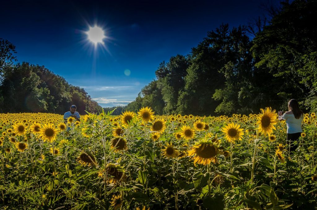
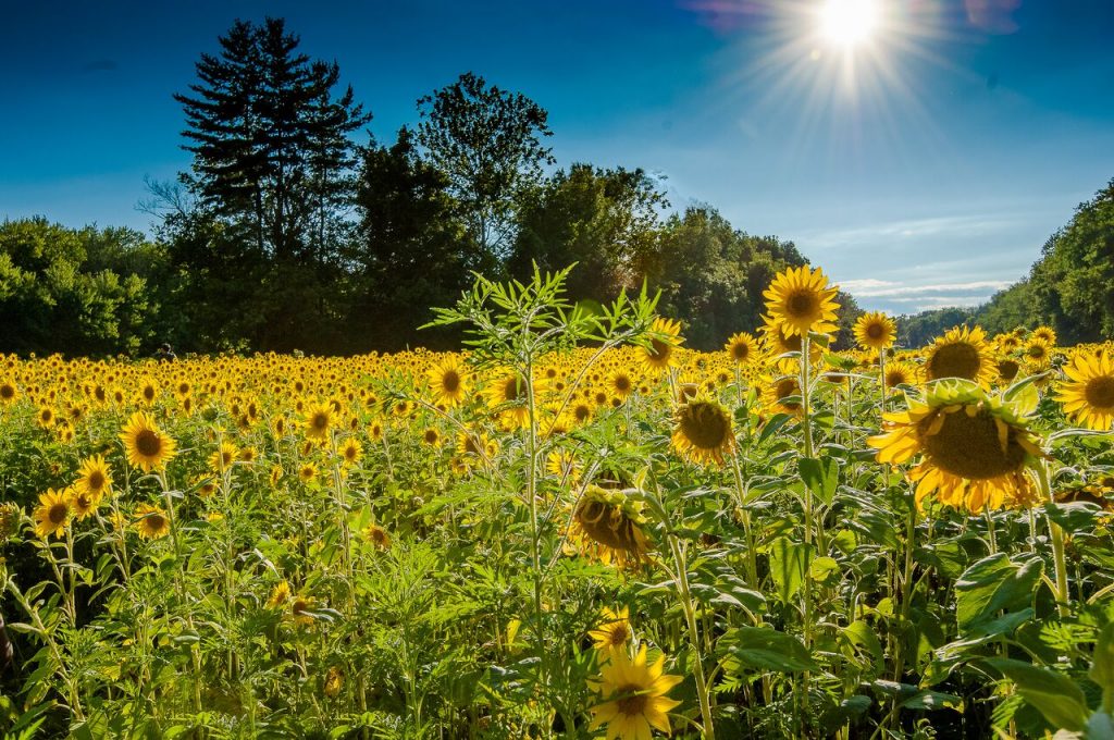
Family taking photos among a field of sunflowers.

You might think field upon field of bright yellow sunflowers are found only in provincial Italy or France, places known for romance and beauty. But there are 2,000 acres right in our backyard that will make you feel transported to a more romantic time and place. Known as the McKee-Beshers Wildlife Management Area (WMA), staff at this park plant acres of sunflowers to attract and feed pollinators and birds. For a couple weeks each year (around the end of July) the WMA is alight with seemingly endless summery flowers.

Just like birds, people flock to the area for family photos, nature photography, and to enjoy the sites. Catch the flowers at full bloom this year for the two weeks following July 24. Meandering trails throughout the fields let you explore without damaging the flowers. However, look but don’t pick; plucking one of these beauties is prohibited at the WMA.

Flowers at McKee-Bashers Wildlife Management AreaWhen sunflowers aren’t the main attraction, there are plenty of trails to hike or bike in the area. Since they are connected to the C&O Canal trail system, the WMA trails makes for a nice side trip or starting point on the Canal. Hunting  waterfowl, deer, wild turkey and other animals is allowed (within the usual hunting regulations). There is even a specially managed dove field open to the public for hunting. Birding and wildlife photography are popular activities at the WMA due to the abundance of wildlife, including 200 species of songbirds found in the area. The more adventurous can take a boat across the Potomac to reach Maddux Island, which is part of the WMA.

A beautiful trail follows some of the perennial marshy flatlands where waterlilies and other aquatic plants abound. Parts of the WMA are managed as a greentree reservoir, a term used for bottomland hardwood forest that is flooded in the fall and winter. This attracts colorful migrating waterfowl, such as wood ducks.

The park, in western Montgomery County, Maryland, is conveniently located right off River Road. It is not difficult to find, just plug “McKee Banshee Management Area” into your GPS and look for the parking lots full of cars and people in incongruously fancy dress for a hike. After all, this is a popular place to take family photos. There are several ways to access the fields, but most involve a short walk through the woods that is often muddy, so make sure to wear appropriate footwear.

Photo Credit: Hunter Herrman