River Report – New historic minimum flows
There is now a lot of red on the U.S. Drought Monitor map, with 43% of the watershed in Extreme Drought (red) and 28% in Severe Drought (dark orange).
River flows in some areas of the watershed are reaching new record lows. The river flow at the USGS gages at Shenandoah River at Millville, WV, and South Branch Potomac River near Springfield, WV, both hit a century-old recorded historical low this week.

Adjusted flow at Little Falls as of July 17, 2024
Closer to the DC Metro area, the adjusted flow at Little Falls is hovering around the 10th percentile (see the graph).
Some jurisdictions across the western part of the Potomac River watershed are asking residents to conserve water, while some communities are making cutbacks mandatory.
Low river flows, lack of scouring pulses from rain, and record-breaking temperatures are leading to a series of algal blooms throughout the basin. Health officials recommend you (and your dog!) avoid contact with algal mats, especially if the water is discolored, murky, or smelly.
ICPRB continues daily drought monitoring. Check out #droughtmonitoring on social media to see our daily report on river flow, water demands, and weather forecasts.
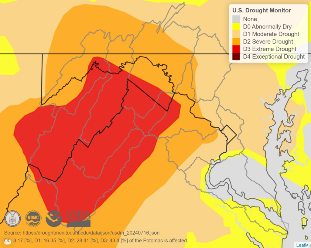
U.S. Drought Monitor map in the Potomac River watershed (gray outline) as of July 16, 2024